Imías is considered as a reservoir of historical events for the province and the Country, which is based on the following:
- There are more than twenty aboriginal settlements, standing out more than 5 caves with pictographs of our ancestors.
We had the virtue of having been a visitor by the first Cuban historian Presbyter Pedro Morell de Santa Cruz in December 1757. - The presence of José Policarpo Pineda Rustán from 1866.
- On June 1, 1869, the Greepesho Ship disembarked at Playa Guardaraya (Today division of Imías and San Antonio del Sur). Forty fighters from the United States who came to join the mambises of the Ten Years War.
- On June 26, 1869, Colonel José Policarpo Pineda Rustán raised Imías in arms. This feat is recorded as the first combat in the Blades of Arroyo Jojó.
- Presence of Antonio Maceo in Palenque de Yacabo Arriba, who, applying the tea, reduced that farm to ashes in 1871. In addition to fighting in Manacabajo and Arriba
- April 11, 1895, landing by Playita de Cajobabo de Martí, Máximo Gómez and other patriots.
- April 15, 1895, José Martí was named Major General of the Liberation Army at the El Descanso farm.
- On November 14, the release of Imías occurs, considered the brightest Combat of the Second Eastern Front.
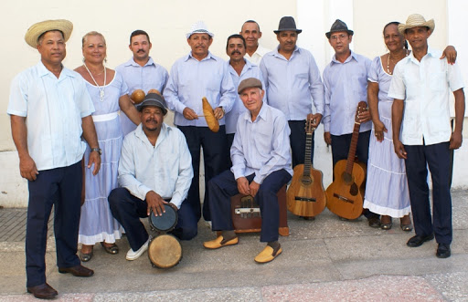
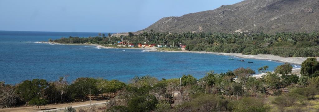
It is a territory with coastal and mountainous characteristics (more than 90%), made up of the rest by a narrow coastal strip that is bounded by the La Colorada hill (wider part) and small alluvial valleys such as those of the Imías and Los Cerezos rivers. Peculiarities that make their environment and their people different, until turning them into eternal defenders of Culture, nature and History.
It emerged as a municipality with the Administrative Political Division in July 1976. It comes from the aboriginal word applicable to the mountain group located north of that town. It is located in the Southeast of the Guantánamo province, its limits are by:
- North: Baracoa Municipality.
- This: Maisí Municipality.
- South: Caribbean Sea.
- West: San Antonio del Sur Municipality.
")
")

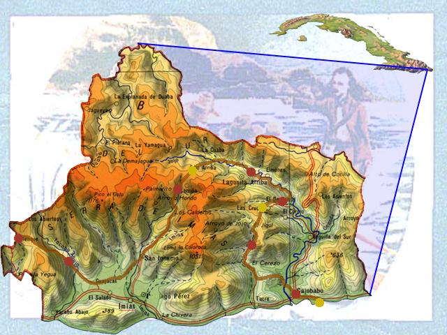 The territorial extension is 527.48 km2, with a density population of 40.1 inhab / Km2. Its climatic conditions show notable differences, the southern coastal strip known as the Cuban semi-desert; the northern part influenced by notable rainfall. The climate shows notable differences between the southern region, included in the semi-arid zone of Cuba (southern coastal strip), a very fragile ecosystem due to the lack of rainfall and high temperatures, it is part of the climatic subregion of Eastern Cuba, for which it exhibits semi-arid characteristics thanks to its position with respect to the Nipe-Sagua-Baracoa mountainous massif and in particular the Sierra de Imías, with rainfall values below 800 mm average per year and temperatures above 260C.